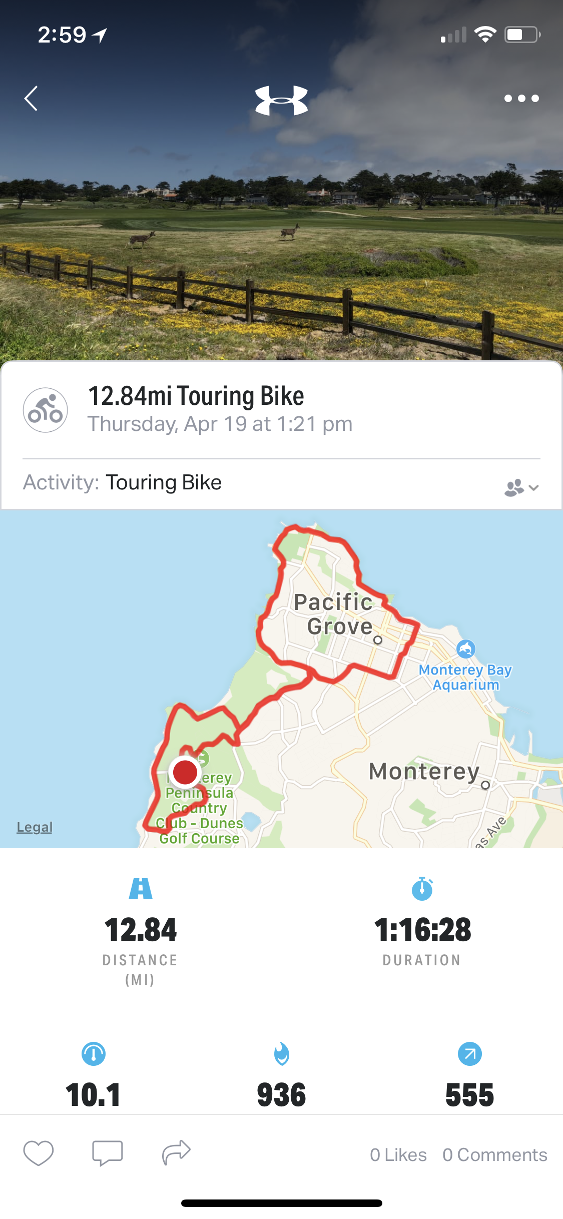
Today's Bike Route - Click picture to enlarge
| Back to April 18 | April 19, 2018 | On to April 20 |
Today's Bike Route - Click picture to enlarge
I have a iPhone App, Map My Ride, that tracks where I go, how fast I'm going, my cadence and my heart rate. This helps motivate me. In this example, I rode out to Pacific Grove along the water, came back through town and back on Stevenson Drive. This was 12.84 miles, took 1:16:28 (I took a break at the water in PG) and burned 936 calories.
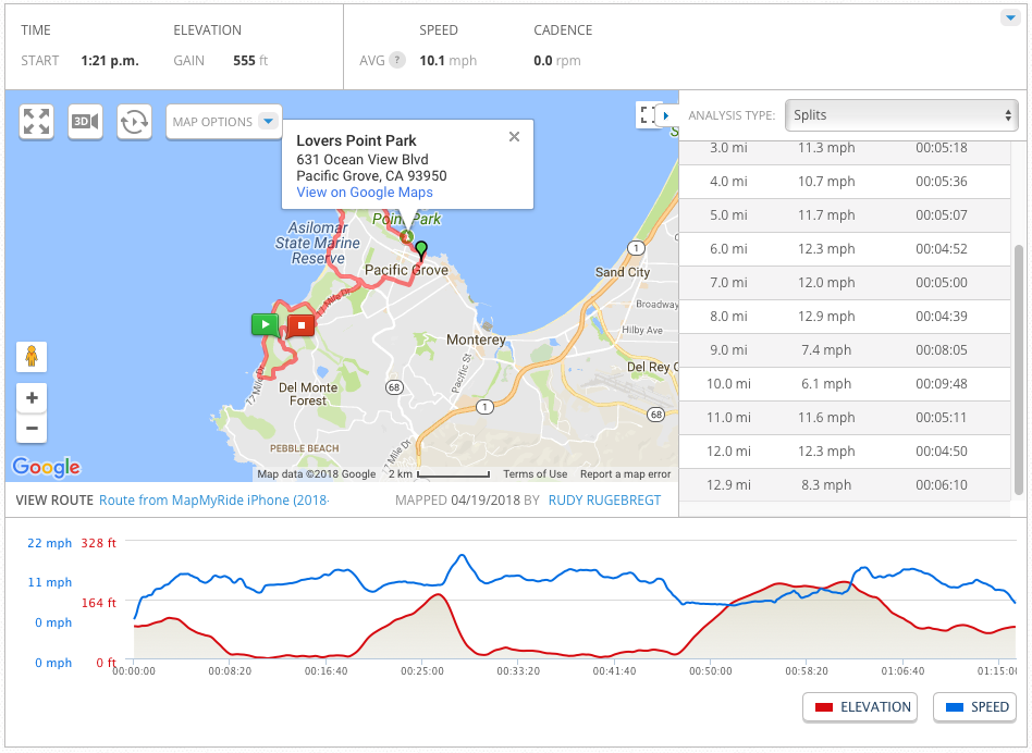
Ride Details - Click picture to enlarge
| Back to April 18 | rudy@rugebregt.com | On to April 20 |